8.50.030 Area Defined.
The geographical area in the City of Vancouver described below is declared to be an Alcohol Impact Area as defined by WAC Section 314-12:
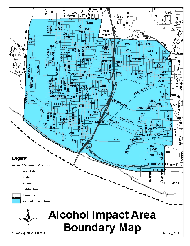
That area starting at the corner of 39th Street and NW Fruit Valley Road proceeding south on NW Fruit Valley Road upon termination of NW Fruit Valley Road proceeding due south to the Columbia River then proceeding south-east along the Columbia River toward Interstate 5 and connecting with SE Columbia Way proceeding south south-east to where South Grand Boulevard would intersect with SE Columbia Way then proceeding north on South Grand Boulevard to North Grand Boulevard to Grand Boulevard Then proceeding west on East 33rd Street then proceeding north-east on St. Johns Boulevard then proceeding west on SR 500 to its connection with East 39th Street then proceeding west on East 39th Street then proceeding north on Main Street then proceeding west on NE 45th Street to its end at Lincoln Avenue then proceeding due west to NW Fruit Valley Road then proceeding south to West 39th Street.
The boundaries shall include properties located on both sides of the public right-of-way that constitute the boundaries of the Alcohol Impact Area as further depicted on the attached map.
(Ord. M-3867 §4, 2008)